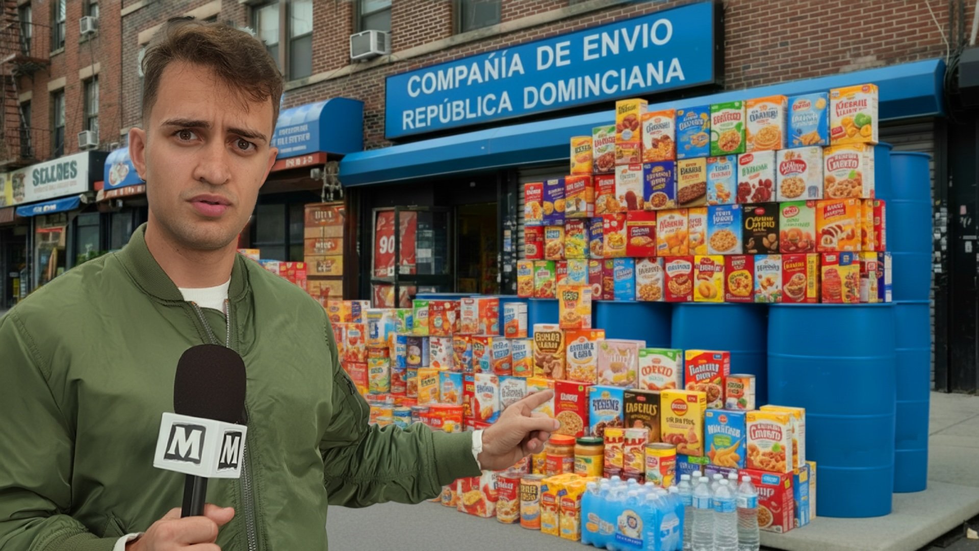
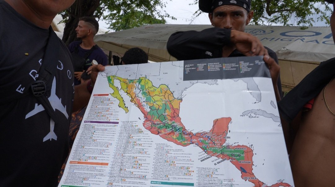
Muckraker has obtained multiple maps, handed out by non-government organizations across South and Central America, that detail the routes to take to the U.S. and where to cross the U.S. border.
These maps are hardly reported on by the mainstream media since illegal aliens usually lose the maps along their way.
We were able to obtain these blueprints by directly visiting numerous NGOs along the mass migration route through South and Central America.
The collapse of the U.S. southern border is the result of a carefully planned and deliberately executed industrial mass migration program.
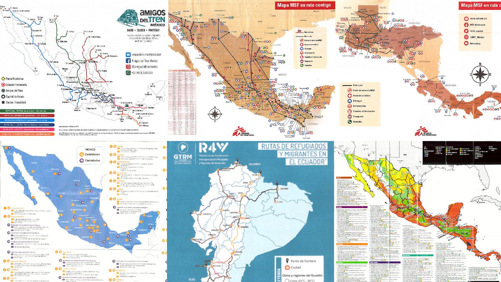
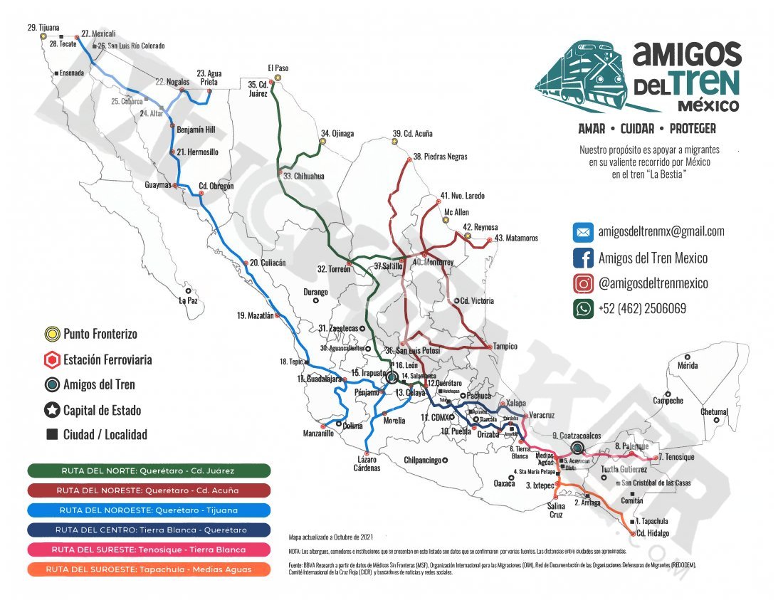
MAP #1 - Distributed by the NGO Amigos Del Tren (Friends Of The Train in English).
This NGO aids illegal aliens in riding the "Train of Death", (also known as "La Bestia"), a freight train that U.S.-bound illegal aliens ride on top of to reach the U.S. border.
The front shows the train routes across the country of Mexico.
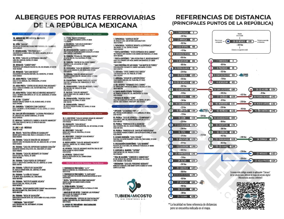
The back lists numerous hostels that can be found along the train routes and also shows the distances between Mexican cities.
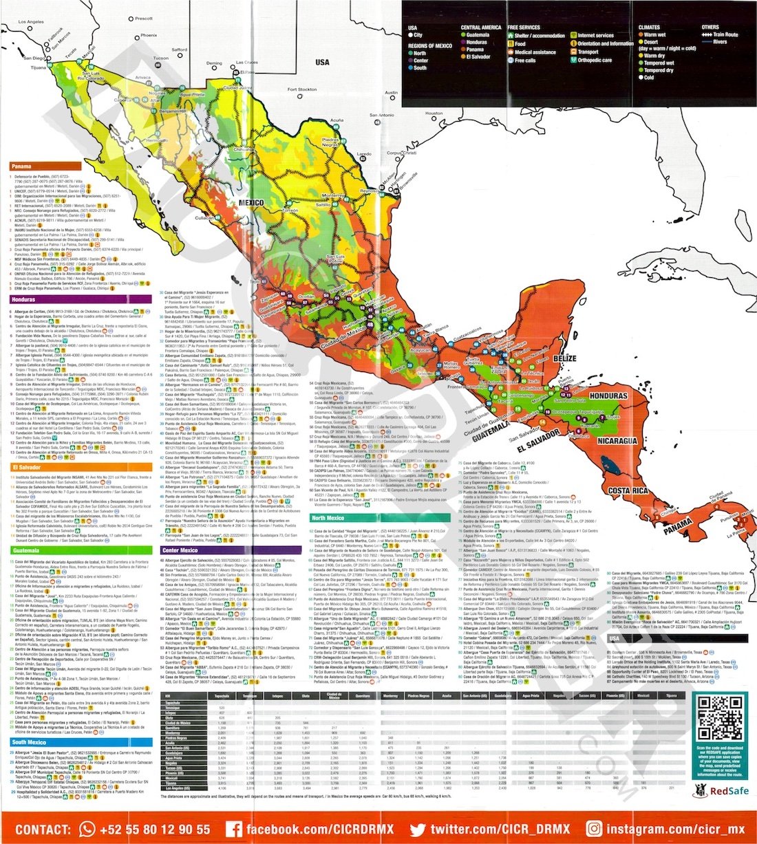
MAP #2 - Distributed by the Red Cross.
The front shows the freight train routes across Mexico (similar to the Amigos Del Tren map) and lists 80 different stops from Panama to the United States.
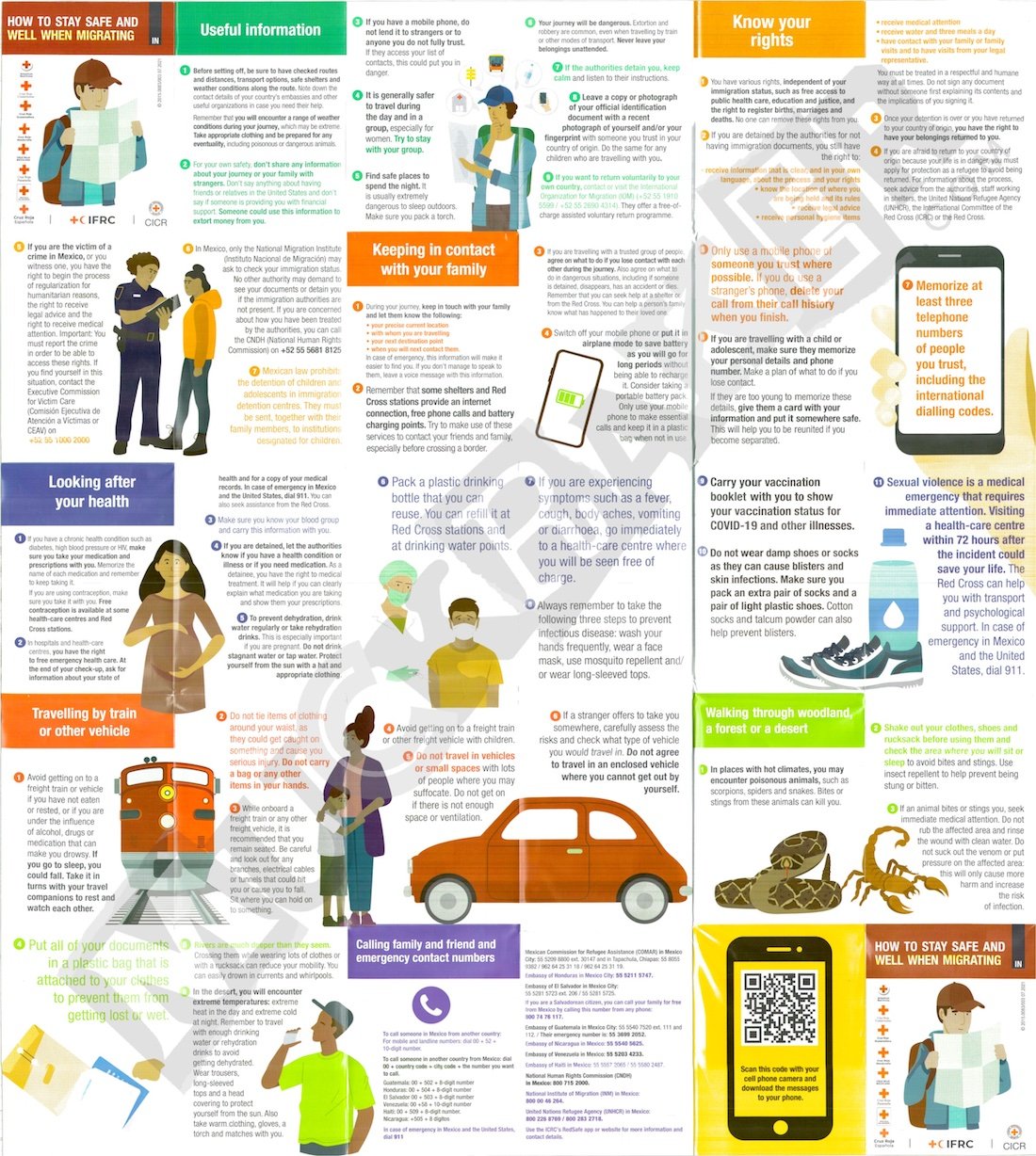
The back gives advice on navigating the mass migration trail. One piece of advice given is how to safely ride a freight train. It is advised to avoid riding a freight train if ". . . you are under the influence of alcohol, drugs or medication that can make you drowsy."
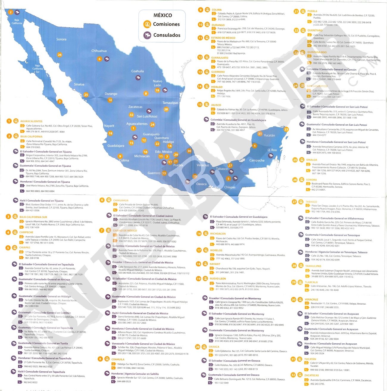
MAP #3 - Distributed by The United Nations International Organization of Migration (IOM).
It shows various commissions and consulates across the country of Mexico.
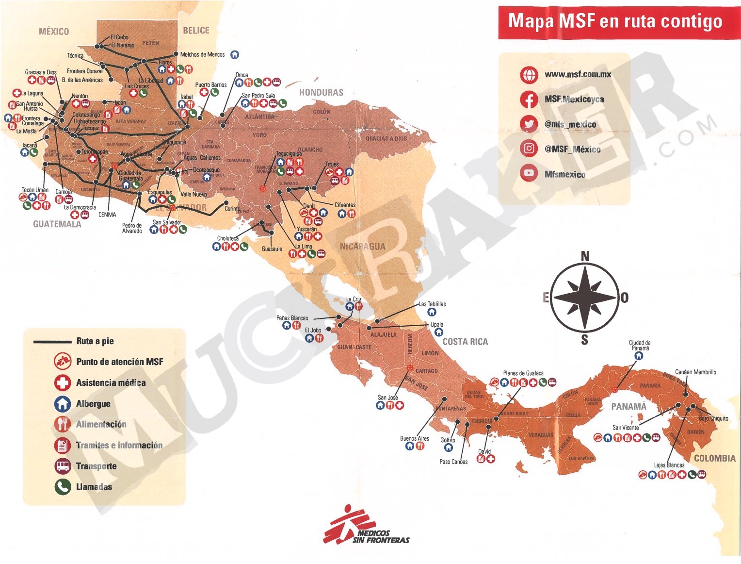
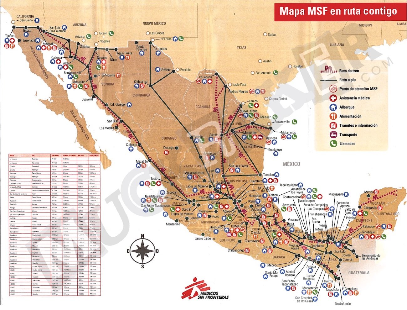
MAP #4 - Distributed by Doctors Without Borders (Médicos Sin Fronteras in Spanish).
The front shows the routes from Panama to Mexico.
The back shows the routes across Mexico to the United States.
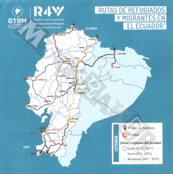
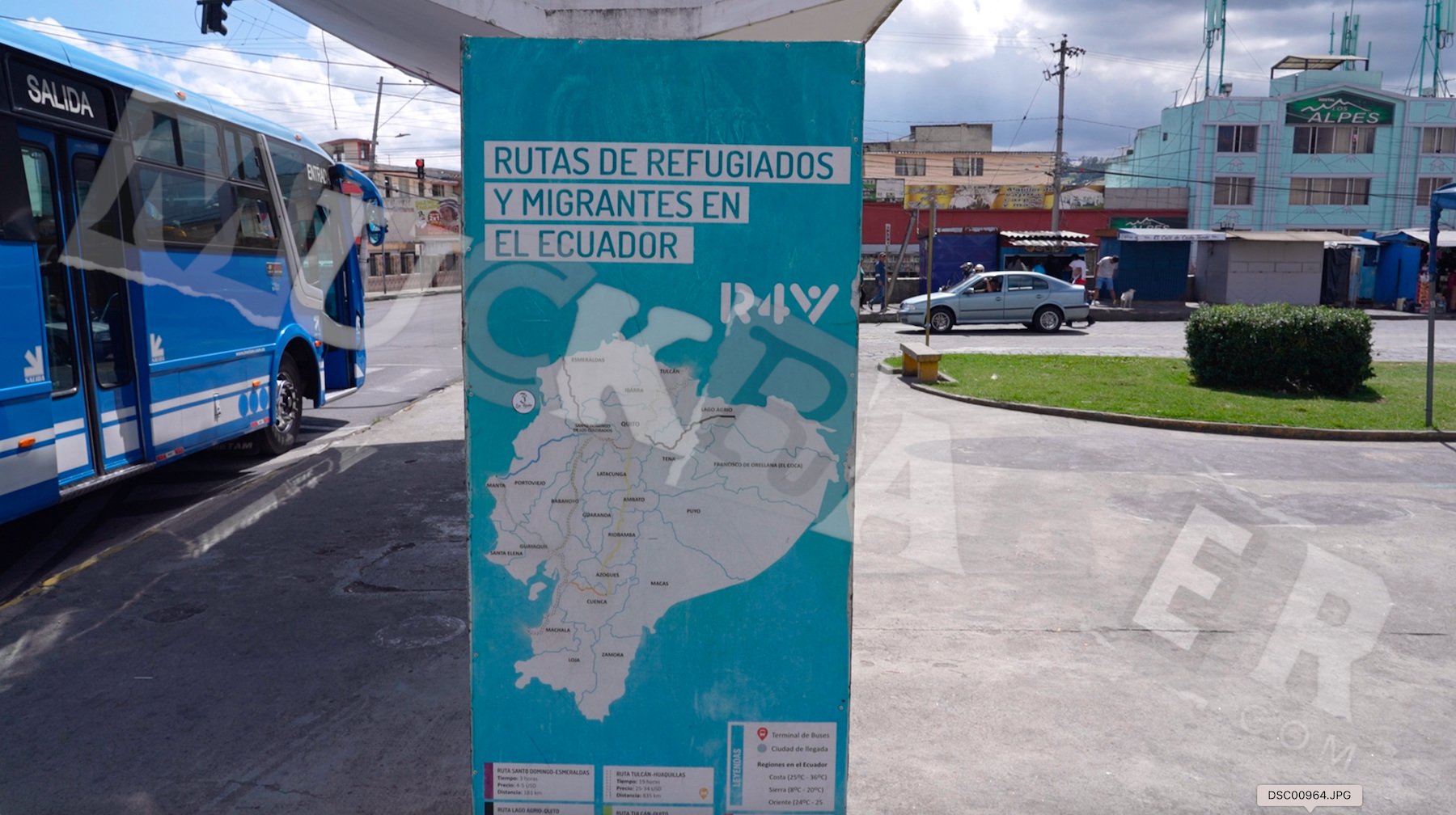
MAP #5 - Distributed by R4V (Refugees and Migrants from Venezuela).
The front shows the "migration routes" across the country of Ecuador.
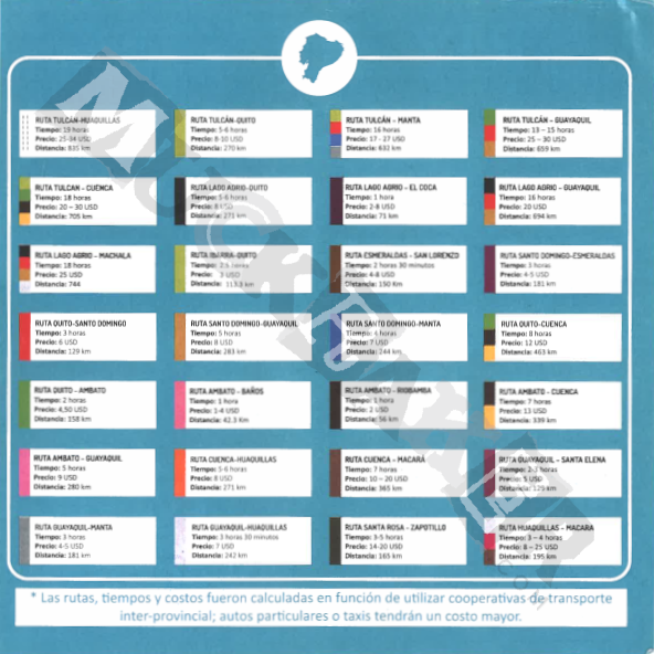
The back shows the distance and transit times between Ecuadorian cities.
These maps are distributed by NGOs across the country of Ecuador and are also openly displayed in public areas such bus terminals.

Only for Premium Members
MUCKRAKER PREMIUM
ONLY $7.50 MONTH (BILLED ANNUALLY)
-
Access to EXCLUSIVE Muckraker content including interviews, pictures and research articles
-
Ad-free environment
-
Access to the Muckraker newsletter
-
Access to the comments section